IMAGE INFORMATION
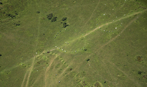
EditOn the gentle south-facing slope of Minions Moor, a landscape heavily scarred by mining and quarrying, stand the three great stone circles known as the Hurlers. Folk tales explain that the stones represent local people turned to stone by a humourless deity for playing the game of hurling on the Sabbath. To the south-west are a pair of standing stones known as the Pipers – presumably Hurling was played to a musical accompaniment.
Although not set out in a straight line, the centres of the circles trend towards the ridge to the north, with the still impressive bulk of Rillaton Barrow on the near horizon and the summit of Stowe’s Hill with it’s Neolithic tor enclosure and the striking natural granite formation known as the Cheesewring on the skyline. Dating to the early Bronze Age, the Hurlers lie in a remarkable ‘ceremonial landscape’ of stone circles, stone rows, standing stones, cists and cairns. A particular feature of the monuments in this area is their tendency to ‘refer to’ significant tors and horizon features, especially the tor enclosure on Stowes Hill and the group of large barrows on Caradon Hill. The numerous alignments apparent in this area suggest that the Hurlers may have been part of an important processional route.
The area has been extensively disturbed by mining and only the central circle has a large proportion of its stones in-situ, but this is because they were reset after the site was excavated by Raleigh-Radford in 1935-6. Fourteen stone uprights survive in the central circle, with fourteen markers for missing stones, placed in empty stone sockets during restoration works. Originally all the circles are said to have contained twenty nine stones (though the central circle is considerably larger than the other two) and it was Carew who noted the “...strange observation that a re-doubled numbering never eveneth with the first”. The inner faces of the stones are smooth and regular and most of the stones are flat topped and graded so that the tallest stones are to the south, which may support the idea of a processional route through the circles leading towards the north. This is also the case with the north circle and possibly also the south circle - though this is now in a very poor and incomplete condition. It has been noted that flat lozenge shaped stones tend to alternate with more slender uprights and it has been proposed that the former represent the feminine principle whilst the latter represent the masculine. Excavations revealed a quartz crystal ‘floor’ within the central circle and the small granite block currently sited within the circle may originally have marked the true centre.
Two standing stones known as the Pipers lie to the south-west of the Hurlers flanking a modern boundary bank. ‘Outliers’ such as these are a common feature of stone circles in Cornwall and further afield and they are likely to be prehistoric in origin, re-used as a prominent landmark when the boundary was first established. Interestingly, both the Pipers and the Hurlers fall on an approximate alignment between the ‘embanked avenue’ and stone circle on Craddock Moor and the prominent barrow group on Caradon Hill. The Pipers may thus represent a ‘portal’ giving access to the Hurlers from the west.
The Hurlers can be reached by level tracks from car parks located on the north and south sides of Minions village. Close to the northern car park, Houseman’s engine house is now a base for the Caradon Countryside Service and contains displays on the archaeology, history and ecology of the surrounding moors.


